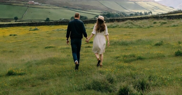
Allithwaite provides direct access to an excellent selection of walking routes in South Cumbria.
Positioned near Morecambe Bay and the southern part of the Lake District, the village connects to coastal paths, woodland trails, farmland tracks and moderate ascents.
The area delivers options suited to different fitness levels and time available, from quick flat outings to full-day challenges with extensive views.
This guide covers six established routes, each with clear details on distance, duration, difficulty and practical features to support effective planning.
Kents Bank Circular
This easy circular walk offers a gentle way to explore the paths around Kents Bank.
The route follows quiet local lanes and footpaths with minimal climbing and stays close to the coastline.
Walkers gain pleasant views across the estuary throughout.
It forms a suitable choice for a short outing or a relaxed start to the day in the Allithwaite area.
- Length: 1.8 miles (2.9 km)
- Estimated time: 45 minutes to 1 hour
- Difficulty: Easy
- Elevation gain: 216 feet (66 metres)
- Route type: Circular
- Starting point: Kents Bank area
- Key features: Gentle terrain, local paths, proximity to the bay
Related: Best Greenodd Walks
Grange-over-Sands to Morecambe Bay
A level coastal walk follows the promenade from Grange-over-Sands southwards beside the railway line.
The path heads directly towards the sands of Morecambe Bay and provides open views across the water.
With very little ascent, the route suits all abilities and is an ideal short walk when time is limited.
- Length: 2.1 miles (3.4 km)
- Estimated time: 30 minutes to 1 hour
- Difficulty: Easy
- Elevation gain: 157 feet (48 metres)
- Route type: Out-and-back
- Starting point: Grange-over-Sands railway station and car park
- Key features: Coastal promenade, extensive bay views, flat terrain
Related: Dalton-in-Furness Walks
Grange-over-Sands Eggerslack Wood Circular
This circular route explores Eggerslack Wood and adjacent fields near Grange-over-Sands.
The path moves through woodland sections before opening out into grassland areas.
Gentle gradients and good tree cover make it a comfortable choice, especially on warmer days.
Views towards the bay appear from several points along the way.
- Length: 3.7 miles (6 km)
- Estimated time: 1.5 to 2 hours
- Difficulty: Easy
- Elevation gain: 711 feet (217 metres)
- Route type: Circular
- Starting point: Grange-over-Sands area
- Key features: Woodland trails, grassland paths, bay views
Hampsfell
The route to Hampsfell takes walkers up to the summit area of this outlying fell.
The path crosses interesting limestone pavement and reaches the distinctive stone Hospice building at the top.
From the high point, extensive views open out across Morecambe Bay and the surrounding fells.
This makes a rewarding moderate ascent with clear geological interest.
- Length: 2 miles (3.2 km)
- Estimated time: 1 to 1.5 hours
- Difficulty: Moderate
- Elevation gain: 360 feet (110 metres)
- Route type: Out-and-back
- Starting point: Paths above Grange-over-Sands (accessible from the Allithwaite direction)
- Key features: Limestone pavement, Hampsfell Hospice, panoramic views
Kents Bank and Flookburgh
This longer out-and-back trail follows the shoreline and estuarine landscape between Kents Bank and Flookburgh.
The walk passes through Humphrey Head Wood, known for its ancient stunted oak trees, before reaching more open coastal ground.
It offers good opportunities to observe birdlife along the bay and suits walkers seeking a longer, mostly level experience.
- Length: 11.2 miles (18 km)
- Estimated time: 4 to 4.5 hours
- Difficulty: Moderate
- Elevation gain: 459 feet (140 metres)
- Route type: Out-and-back
- Starting point: Near Kents Bank station
- Key features: Humphrey Head Wood, coastal paths, views across Morecambe Bay
Cartmel, Grange-over-Sands and Allithwaite Circular
The longest route in this guide forms a large circular walk that links Cartmel, Grange-over-Sands and Allithwaite.
The path crosses farmland, passes through woodland and includes a significant climb onto Hampsfell.
Descents offer wide views over Morecambe Bay and the southern Lake District fells.
This full-day walk provides varied terrain and makes a substantial challenge for experienced walkers.
- Length: 10.3 miles (16.6 km)
- Estimated time: 5 to 5.5 hours
- Difficulty: Hard
- Elevation gain: 1,656 feet (505 metres)
- Route type: Circular
- Starting point: Cartmel village
- Key features: Farmland paths, steep ascent of Hampsfell, coastal and fell views, options for refreshments
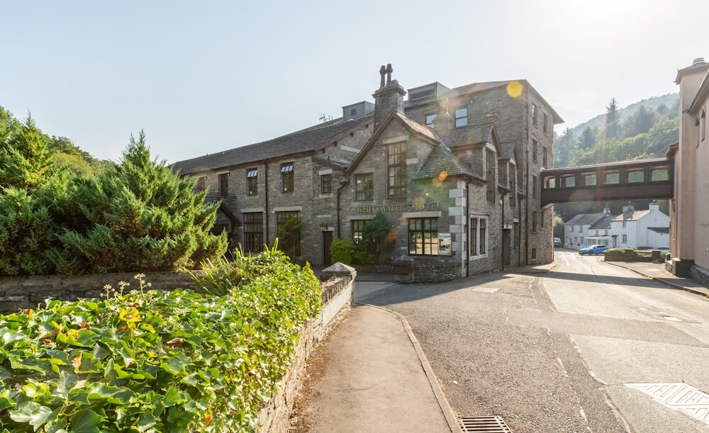
Where to Stay On Your Trip to The Lake District
The Whitewater Hotel provides a convenient and comfortable base for exploring the walks around Allithwaite and South Cumbria.
Its excellent location allows easy access to the routes described above, as well as many other attractions in the area.
Guests can return from a day on the fells or coast and enjoy quality accommodation and facilities.
Book your stay at The Whitewater Hotel here…
Final Notes On Walks Near Allithwaite
Allithwaite serves as a practical starting point for a variety of walks that showcase the best of South Cumbria.
From short, easy coastal strolls to longer and more demanding circular routes, the area caters to different fitness levels and interests.
Always check the weather conditions before setting out, wear appropriate footwear, and carry a map or a navigation device.
These walks combine coastal scenery, woodland and open countryside in an accessible part of the region.
Planning routes in advance and respecting the local environment will ensure a safe and enjoyable experience on the paths near Allithwaite.